FALL HIKING
These three trails are located close to each other between Clinton, Goderich and Bayfield and each one is only a kilometre or two in length, so you could do all three in a day.
BANNOCKBURN - One of the best trails to experience the changing of the seasons is Bannockburn Conservation Area managed by the Ausable Bayfield Conservation Authority. This 62-acre park has six different natural communities: Wet Meadow, Eastern White Cedar Forest, Bannockburn River and Walden Creek, Deciduous Forest, Old Field and Mixed Scrub, and Marsh.
The variety of trees gives it a beautiful glow in autumn, along with goldenrod and asters in the wet meadow and old field ecosystems.
There are interpretive signs along the trail giving information about various points of interest.
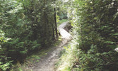
The trail begins with accessible boardwalks and then goes up a rustic set of steps and proceeds through winding and hilly terrain of moderate difficulty. Allow at least an hour to hike the outer loop (about two kilometres). The short side trail will add an additional half hour to your visit, but is well worth the extra time. It circles through a former farmstead and passes what remains of a stone foundation.
The views along the river are pretty and the old iron bridges and boardwalks make for some excellent selfie opportunities. 76249 Bannockburn Line (south of Bayfield Road, between Clinton and Bayfield).
GEORGE C. NEWTON NATURE RESERVE - This 32-hectare property was formerly a farm until it was bequeathed to Ontario Nature, a conservation organization, by a descendant of the naturalist for whom it is named.
A well-marked, 1.2-kilometre trail leads you through what remains of the original orchards and a pine reforestation. A forested ravine is cut through by a clear stream that runs westward through the property. The old stone foundation is all that remains of the homestead, and a side trail will take you along the stream to the remnants of an old mill.
This is a nice trail, with some hills. There is a risk of it being slippery after a rain, so be careful. 35913 Kitchigami Road. (From Highway 21 between Bayfield and Goderich, take Kitchigami Road east. The reserve is located just past Porter’s Hill Line, on the south side of the road.)
SAWMILL TRAIL - The trail starts out on the first pioneer path east of Lake Huron leading from the first ford or crossing point on the Bayfield River. This shallow crossing was probably used for centuries before European settlers came to the area. It was also used as the first bridge and you can still see the pattern of stones in the river indicating where it was located.
The trail is just over 1.5 kilometres long and takes you down a hill and around a loop that follows along the river to a point where you have a great view of the river flats and the bridge across the highway. Across the river, in the underbrush, you can just see all that remains of the old Thomson Mill which was lost to fire over a century ago.
On Highway 21, just north of the bridge in Bayfield, turn right on Old River Road and proceed half of a kilometre and turn right at Sawmill Road, which is the first stop sign. The trail entrance is at the end of this short cul de sac.


